+ WEST MOORS +
This page has details of our location, observing site & instruments etc.
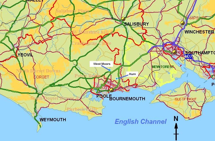
West Moors lies just to the north of the A31 (Ferndown bypass), on the road (B3072) that runs from Ferndown to Verwood. The county boundary (red-solid line) lies not too far away to the east. Our site is on the south-side of the village, at an altitude of 17 m. Also shown in the map above is the location of Bournemouth [Hurn] airport, about 5.5 km (or ~3.5 miles) SE of us, at a slightly lower altitude of ~ 10m.
The area that both West Moors & Hurn lie in is entirely within the ‘Poole Basin’, bounded by the coast / Channel to the south, and the various Downs/Hills to the north and west. To the east, the New Forest has a micro-climate specific to itself, and beyond that lies the major area that makes up Southampton water & the Solent.
Local soils are loose clay/sand mix – very poor heathland type, though somewhat richer soils lie adjacent to the various rivers i.e. Stour, Avon – these being the two closest major rivers; the Uddens stream & Mannington water run to the south and west of the village, draining off the foothills of Cranbourne Chase, which then feeds into the Moors river, which in turn feeds the Stour close to Hurn. These are low-nutrient, acidic watercourses.
In climate classification terms, we are essentially within a warm/mild temperate region, with humidity perhaps higher than further inland (due proximity of Channel waters). Frosts are certainly a feature (too far from coast to avoid), but except at peculiar places like Hurn, the degree of cooling is not excessive. We are reasonably well sheltered from airstreams coming from the north (long land track) and west/NW (combination of Welsh & West Country hills/mountains/moors & our own ‘local’ hills), but fully exposed to the south, saving only that air has to pass across what is now a sizeable conurbation of Poole-Bournemouth. Sea breeze effects are of course notable, given the right synoptic patterns.
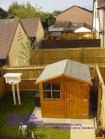
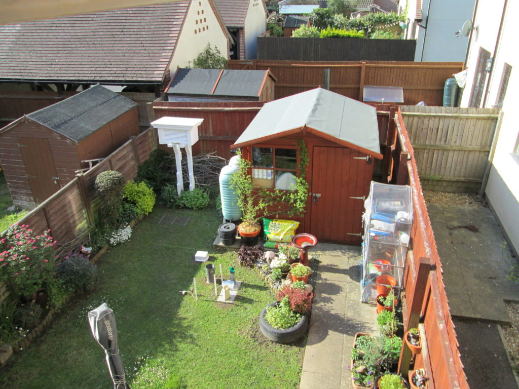
This view of our garden, taken in 2007 (our first year here – below), neatly shows why the readings of both temperature and rainfall must be considered highly unusual! Nothing to be done of course: we couldn’t afford (or cope with) a bigger garden.
… and the view below, taken in spring 2019 after some clearing-up, screen re-painting etc., show that the ‘crowding’ of the instruments has hardly changed – though the garden has.
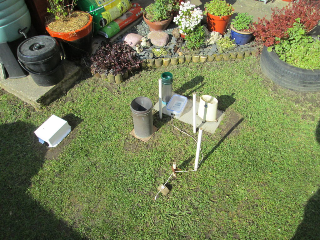
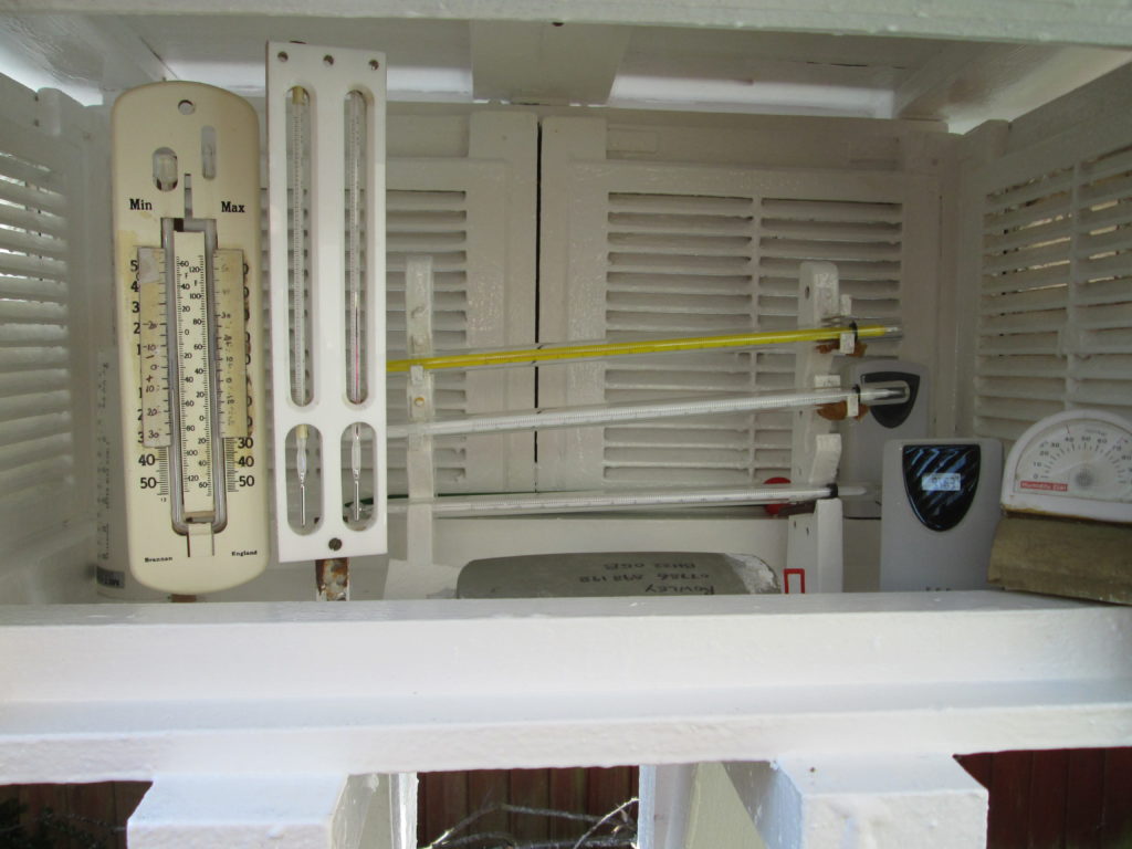
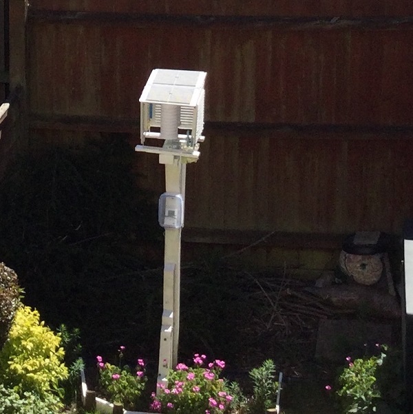
Standard mercury-in-glass maximum, alcohol-in-glass minimum & ordinary sheathed thermometers, with a ‘Sixes’ pattern for checking. I used to have a standard grass minimum thermometer (kept in the screen until put out in the evening) in here but that was replaced by an electronic unit in 2017. There’s also a hair hygrometer – cheap affair, but surprisingly accurate as long as you make certain adjustments. Also you can just make out the electronic temperature sensors the standby / checking rain measure.
Some notes regarding the differences between our highly-sheltered site and a ‘standard’ exposure as represented by nearby Hurn.
RAINFALL: surprisingly, this is not too far removed from that recorded at Hurn airport. Averaged over the period 2008-2018 (11 years) West Moors / Fryer Mews is wetter than Hurn by 0.6% but with a wide range in individual years; from +6.01% in 2012 ( a wet year ) to -6.81% in 2016 ( a ‘near-average’ year ). However, even given the wide range above, this means an average difference of circa just 6 to 7 mm in 100mm, or 0.6 / 0.7 mm in 10 mm, which is hardly dramatic; if we take 30 mm as an arbitrary ‘very wet’ event, then this would lead, statistically to an expected difference of around 2 mm. Whether these differences are genuinely ‘meteorological’ or a function of our non-standard exposure is difficult to say.
And of course it would not be correct to use these relationships in any one situation: individual events, particularly where ‘convective’ elements are concerned, will vary more.
TEMPERATURE: given our back garden location, it is not surprising to find that taking an average over the 24 hours / 12 months, we are about 1C warmer than Hurn.
Minima, when broken down by month, show a remarkable even-ness of anomaly. Between a lower value of +0.9C in January, October and November to the highest value of +1.3C in April with an average of +1.1C; this shows the ‘reservoir’ of heat that the structure of the garden and buildings provide. On individual clear/still nights of course, the difference is much greater . . . 3 or 4C not unusual.
Maxima are more variable: the five months October to February, with low solar elevation (less ‘capture & storage’ of heat by the adjacent buildings), the difference in averages are in the range zero to +0.6C, with November to February having the lowest difference.
The months when solar radiation is being most effectively captured lie between March and September inclusive. All show differences equal to or greater than 1C, with April to July between +1.4 and +1.6C. As with minima, these averages mask some dramatic differences on individual occasions: on hot, intensely sunny, near wind-less days, the values are at least 3C and frequently 4C or more above ‘open country’ maxima.
UPDATE: SPRING 2021
All things come to an end … and I’m afraid my self-built ‘standard’ thermometer screen, built when I lived in Bracknell, has gone to the great Met Office in the sky. Being largely constructed of wood, several years of patching up and bracing will eventually find us out!
I’ve used some of the remnants to make this ‘shelter’ but frankly it looks like the original, much maligned (rightly) Kew North Wall screen, and consequently I’m not sure it’s going to be of much use … still. Keep going eh?!